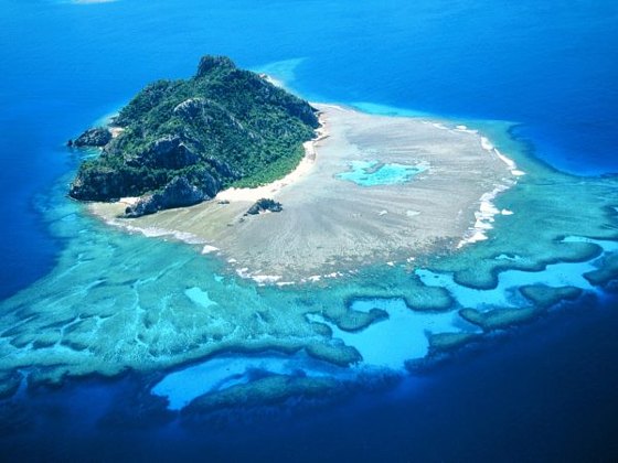
Viti Levu is one of the largest Fiji islands. Being an archipelago we can assume that the islands must have come from some sort of volcanic activity. Fiji happens to lay between the Australian- Indian and the Pacific plate boundary. This subduction zone leads to not only Fiji being formed, but all of the islands in that part of the ocean.
This island was formed much like the Andes Mountains except that it is an ocean plate subducting under another ocean plate. This creates heat as the two plates rub against each other creating enough heat to melt the rock causing it to rise to the surface. Several volcanoes began to form from these pockets of magma rising. Mt. Tomanivi, formally known as Mt. Victoria, is the volcano on Viti Levu. It is a shield volcano, but after being underwater several times and with land moving from tectonic forces it became a different shape.


Chad,
ReplyDeleteYou did a great job!
The last picture shown in the post was the most "descriptive" for me. It shows the forms and processes that were detailed by you very well - such as the shape of the islands shield volcano, Mt. Tomanivi.
I also think you did a good job describing the how Viti Levu was formed, one by comparing it to the formation of the Andes Mountains, and two by explaining in detail the process of subduction.
Your final paragraph that talks about the activity of the volcano was a good final touch for the reader. It was a solid ending for your first post and leaves a lot of room for expansion in the future.
Last, pointing out that the landscape has been changed by other processes was an important detail that really solidified your work. I look forward to learning more about "your island!"
The comment above was posted by Loraine Fishman
ReplyDelete