Fiji is a group of islands in the southwest part of the Pacific Ocean with other places such as Vanuatu, Kiribati, and the Marshall Islands. Volcanic activity was the process in which allowed Fiji to appear above sea level. Fiji lays on a portion of space between the Pacific and the Australian plate which is believed itself to be a plate called the Fiji plate. The Australian and Pacific plate subduct under the Fiji plate creating the unique islands.
 |
Image depicting the locations of the Pacific and Australian plates to the Fiji plate.
The plate boundaries are still hard to explain, but it was, at a time, subducting from both sides.
|
The subduction zones added a situation in which volcanoes would form. The friction down the plates would heat up the rock melting it and it would rise as a result of being liquid and being very hot. The volcanoes built up the hundreds of islands in the South Pacific and left the notable Mt. Victoria which created Fiji's largest island Viti Levu.
 |
Mt. Victoria which is now an inactive volcano was what created the island with its eruptions adding lava
to the surface of the earth. |
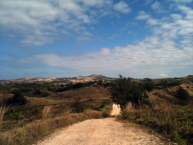
With Viti Levu's location being in the South Pacific it is no surprise that the island is tropical with a monsoon. The monsoon brings rain through April to November. Trade winds blow the monsoon season storms East to West across the island. With the mountains in the middle of the island a significant rain shadow occurs dropping water on the East side of the island and less on the West side.
 |
| Windward side of Fiji with lush tropical jungles. |
 |
| Leeward side of Fiji with much dryer conditions. |
However, this perfect island will probably come to an end. Tropical cyclones happen every year and normally bring flooding to the area. This repeated flooding will slowly begin to cause the island to have mass wasting events that will take down the island out to sea, of course of a great deal of time. The island, however, will probably meet it's fate through tectonics. The area is very active in movement which eventually causes earthquakes.
These earthquakes, which also occur often, can have a few varying effects on the island. The island can be physically distorted from the actual movement of rocks, but something greater probably would occur. Being on active plate boundaries the risk of earthquakes reawakening dormant volcanoes is always there. If a volcano erupted the landscape would be greatly changed. The volcanoes are mostly andesite and would probably be explosive. This would cause ash and hot pyroclastic flows to burn the landscape killing vegetation.
Example of a pyroclastic flow occurring at the Unzen Volcano.
Another potential result from an earthquake would be a tsunami occurring afterwords. Tsunamis happen along subducting plates from tension building up and then releasing creating a massive surge of water. With a tsunami the island could have a completely new makeover. Most of Viti Levu's cities are on the coast and a large tsunami would cause massive destruction along the coasts. This would rewrite what many of the low laying areas look like causing large amounts of change from the surge of water.
 |
| Map of the rivers of Viti Levu which will eventually erode the land around them down until they have taken all of the land down to the ocean flattening the island in thousands of years. |
Of course long term weathering will also slowly tear the land down. With the islands 54 rivers soil will be taken down stream out to the ocean until the land is flat. I believe that a new eruption from a volcano will not let that happen though.
Sources:
Youtube
http://www.justpacific.com/fiji/fijiphotos/wrightpics/scenery/nabui.jpg
http://www.fiji.pictures-pacific.com/travel/pictures/03-viti-levu.jpg
http://whatonearth.olehnielsen.dk/plates/fiji.asp
http://en.wikipedia.org/wiki/Category:Rivers_of_Viti_Levu
http://joetourist.ca/fiji/graphics/VitiLevuMap.png


